Type of activity
Mountain biking
Recommended period
March – October
Classification
Provincial
Reference ATL
Ente Turismo Langhe Monferrato Roero
Difficulty
Medium
Length
35 Km
Cycling time
7 hours 50 min
Maximum altitude
267 m
Departure point
Old town
14030 Azzano d’Asti AT
196 m
Arrival point
Old town
14040 Cortiglione AT
209 m
SECTION 1
Length: 4 km
Cycling time: 1 hour
Maximum altitude: 204 m
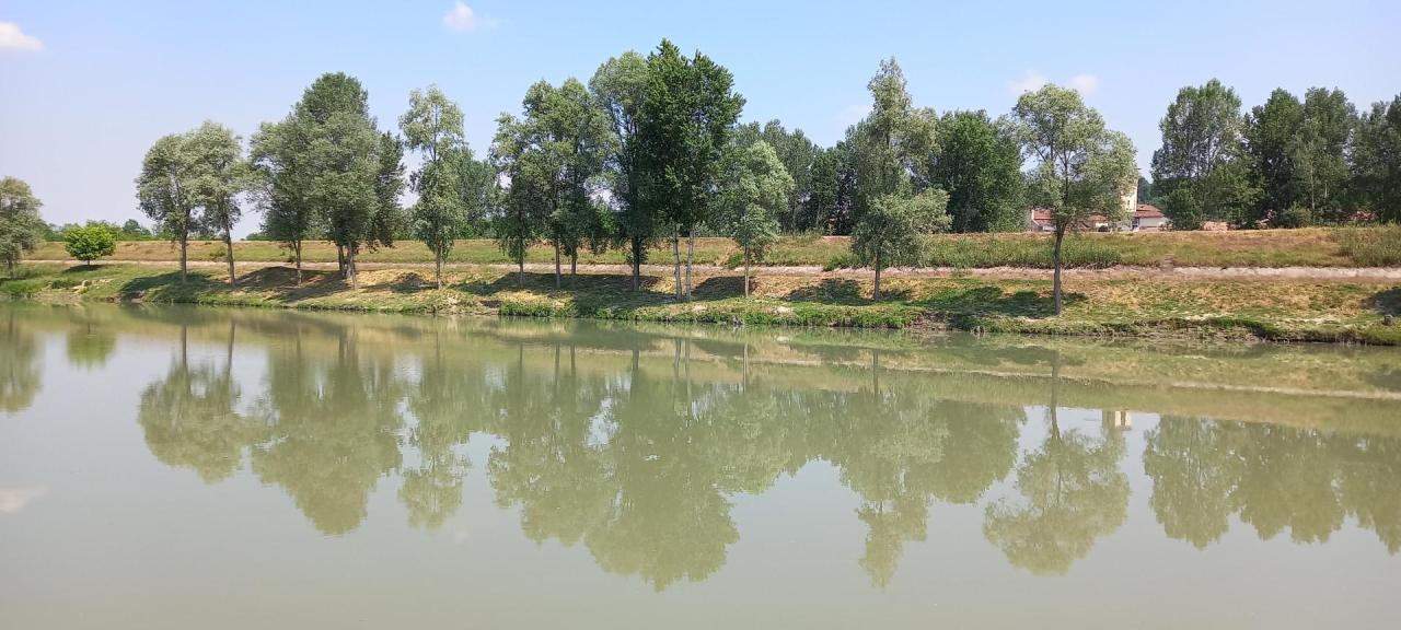
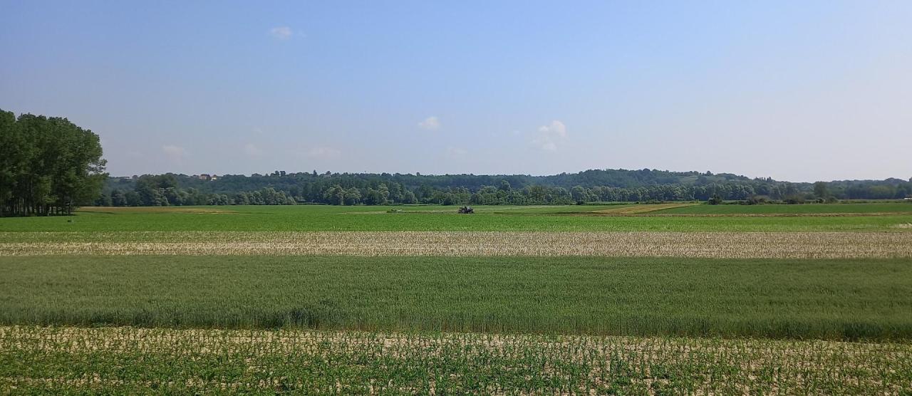
The departure point is in the old town of Azzano, an area characterised by cultivated and woodland areas. The area is also characterised by the presence of the Tanaro river, which affects its landscape and morphology: in fact, these are low sandy hills that become flatter south of the river, hills where poplar is the main and most common tree. The old town is particularly interesting from a historical and cultural point of view, as documented by several sources. The borgo, in fact, dates back to the 12th century; it is in this period that we find the first written historical evidence of the presence of a castle. The trail follows the ancient road connecting the many neighbouring town, now called ‘Strada dell’Impiccacavallo’, as a legend says that a hanged horse was found on that road.
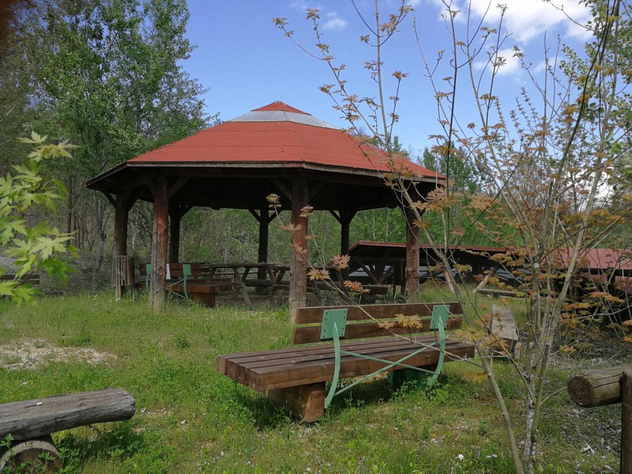
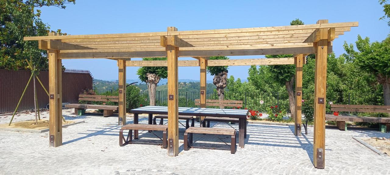
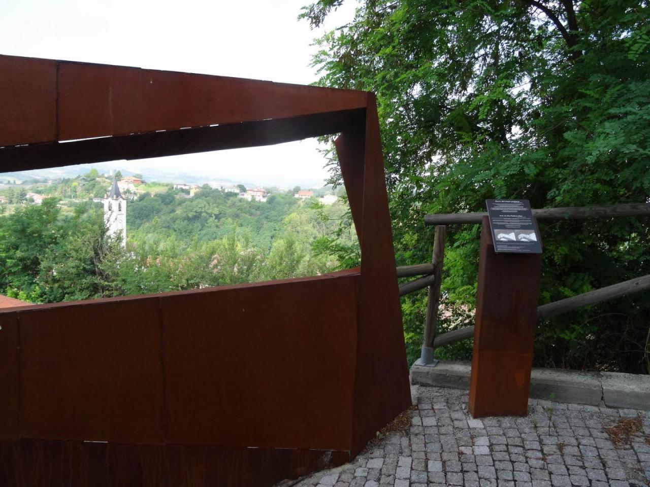
The road continues until it crosses La Via del Mare – a registered itinerary – and then continues along the banks of the Tanaro river until it comes to a crossroads from which, following the road known locally as the Via dell’Amore, it reaches the centre of Rocca d’Arazzo, dominated by Palazzo Cacherano, now the town hall, and former residence of the Cacherano della Rocca family. Next to it is a park from which you can admire a stunning view of the Tanaro valley and the city of Asti, which has earned the town the nickname ‘Balcony on the Tanaro’. The parish church of Santo Stefano and Genesio and the church of Santo Stefano and Santa Rita, dating back to the year 1000 and the arrival point of this first section are also of major importance.
SECTION 2
Length: 9 km
Cycling time: 2 hours
Elevation: 90 m
From the town of Rocca d’Arazzo, arrival point of section 1, the trail continues towards Rocchetta, up to the crossroads at the bottom of the valley, from where it is possible to follow the section of the trail that takes us along the Tanaro river. Following the signs along the Via del Mare, the trail comes to a crossroads leading to the Parco Naturale Rocchetta Tanaro and Gatti. This nature park, managed by the Ente Parchi with headquarters at the regional hostel, is known and recognised for its naturalistic significance. It covers 123 hectares at an altitude of 110 to 123 metres above sea level. Morphologically, the area is part of the hill complex formed by the yellow sands of Villafranca and therefore subject to intense erosive activity. The park consists mainly of mixed oak woodland, especially oak and English oak. Of great naturalistic importance for the history of the Asti area was the study of the vegetation of the park.
Within the park, the ‘Great Beech’ is the most interesting natural-historical arboreal element: a centuries-old specimen more than 25m tall and with a crown more than 20m in diameter, which proves the existence of the ancient beech forests that characterised the last glacial period. Pacha Mama is a hostel located within the park that organises recreational and educational events.
The trail then continues towards Asinara with its picturesque Canà fountain and rejoins the Via del Mare to come to the old town of Rocchetta Tanaro.
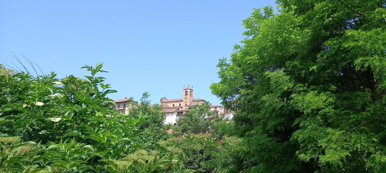
Of Roman origin, Rocchetta Tanaro, after several transfers of ownership owes its current characterisation mainly to the Incisa family, who owned it until the 18th century, when it came under the rule of the King of Sardinia. Evidence of these transfers can be found in the many historical buildings, such as the parish church of Santo Stefano, the Salone Santa Caterina (once the church of the confraternity) and, above all, the church of Santa Maria de Flexio, known as the Ciappellette, due to the tiles – the so-called ‘ciappelle’ – that characterise its wall structure. It is also important because evidence has been found inside it that dates back to Roman times, the earliest settlement of the town. This building can be reached by taking a branch off the main path, directly from the old town.
SECTION 2A
Length: 0.5 km
Cycling time: 10 min
Elevation: 2 m
Cycling along section 01 (Azzano – Rocca) you will find this new route, which gives the opportunity to those who do not wish to get to the town of Rocca d’Arazzo to continue up to the route of section 02, which skirts the river and reaches the centre of Rocchetta Tanaro.
SECTION 2B
Length: 11 km
Cycling time: 2 hours
Elevation: 175 m
From the crossroads that in section 2 led to the Parco di Rocchetta Tanaro, you will head in the opposite direction towards Montaldo Scarampi along the old track that crosses, in order, the small towns of San Carlo Secondo, San Carlo, San Carlo Primo, San Giacomo and Sant’Antonio, all characterised by small dwellings surrounded by large wooded areas.
You will then arrive at Montaldo Scarampi, whose history tells use a very important castle whose remains date back to the 11th century. Impacted by the wars that have affected the Asti area over the centuries, this castle was partially destroyed during the siege of Nice in 1641, when Prince Maurice Thomas of Savoy sent a Spanish cavalry regiment to assault the castle, which was the seat of a French regiment. The battle that followed this event caused the destruction of the castle, which has never been rebuilt and what remains now – some parts of the surrounding walls – are incorporated into the retaining walls of the hill.
SECTION 2C
Length: 1.5 km
Cycling time: 25 min
Elevation: 2m
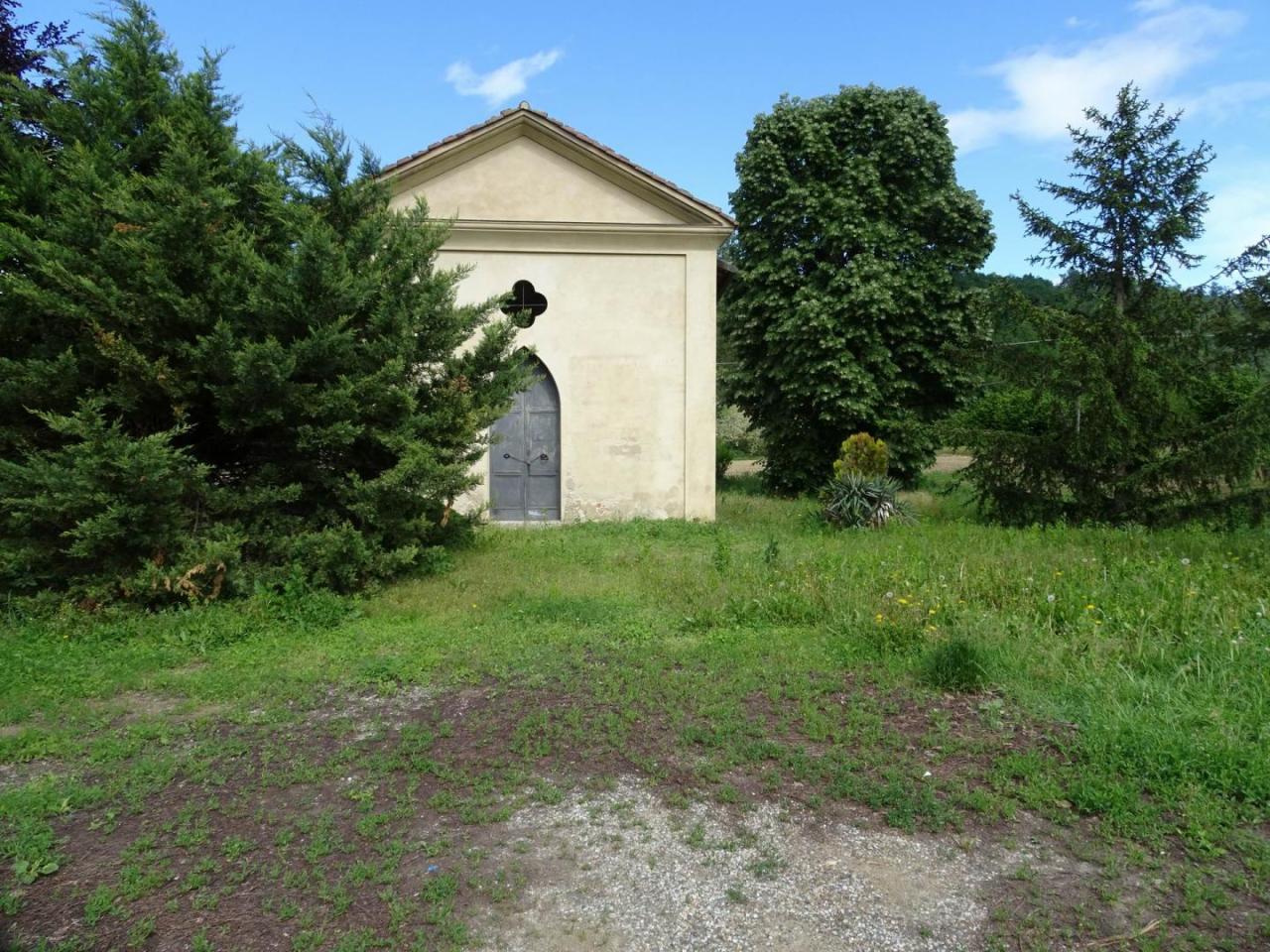
From the built-up area of RocchettaTanaro, you can take another route to reach the church dedicated to S. Maria De Flisco, also known as the Chiese delle Ciappellette because of the characteristic fragments of terracotta that make up its walls (called the ‘ciapelle’ by the locals).
It seems that already in the first half of the 13th century, the church belonged to the Benedictine abbey of Pomposa, while in the 16th century its ownership was transferred to the Seminary of Asti.
The church is a rectangular and cross vaulted building, which ends with a semi-circular vaulted apse. The façade is gabled, bordered by pilasters supporting a triangular tympanum. It is located near an ancient bend in the Tanaro river (flexo).
SECTION 3
Length: 8.5 km
Cycling time: 1 hour 45 min
Elevation: 60 m
From the old town of Rocchetta Tanaro, you will head south along the old road connecting it to Belveglio. This road runs along the crest of the hills to give you the opportunity to admire the stunning views that this area has to offer. Through large wooded areas and agricultural fields, you will then get to the town of Belveglio.
The Belveglio area is surrounded by hills covered with vineyards and wooded areas known for the production of white truffles, typical of Monferrato.
Continuing along the RPE trails, you will get to the town of Cortiglione.
This small town – which dates back to the Roman empire – was formerly known as Corticelle (small courtyard) and was involved in several transfers of ownership from one local family to another and in a centuries-long dispute with Belvedere, a neighbouring town (today Belveglio) until it was incorporated, in 1738, in the fiefs of Charles Emmanuel III, King of Sardinia.
SECTION 3A
Length: 1.7km
Cycling time: 40 min
Elevation: 28 m
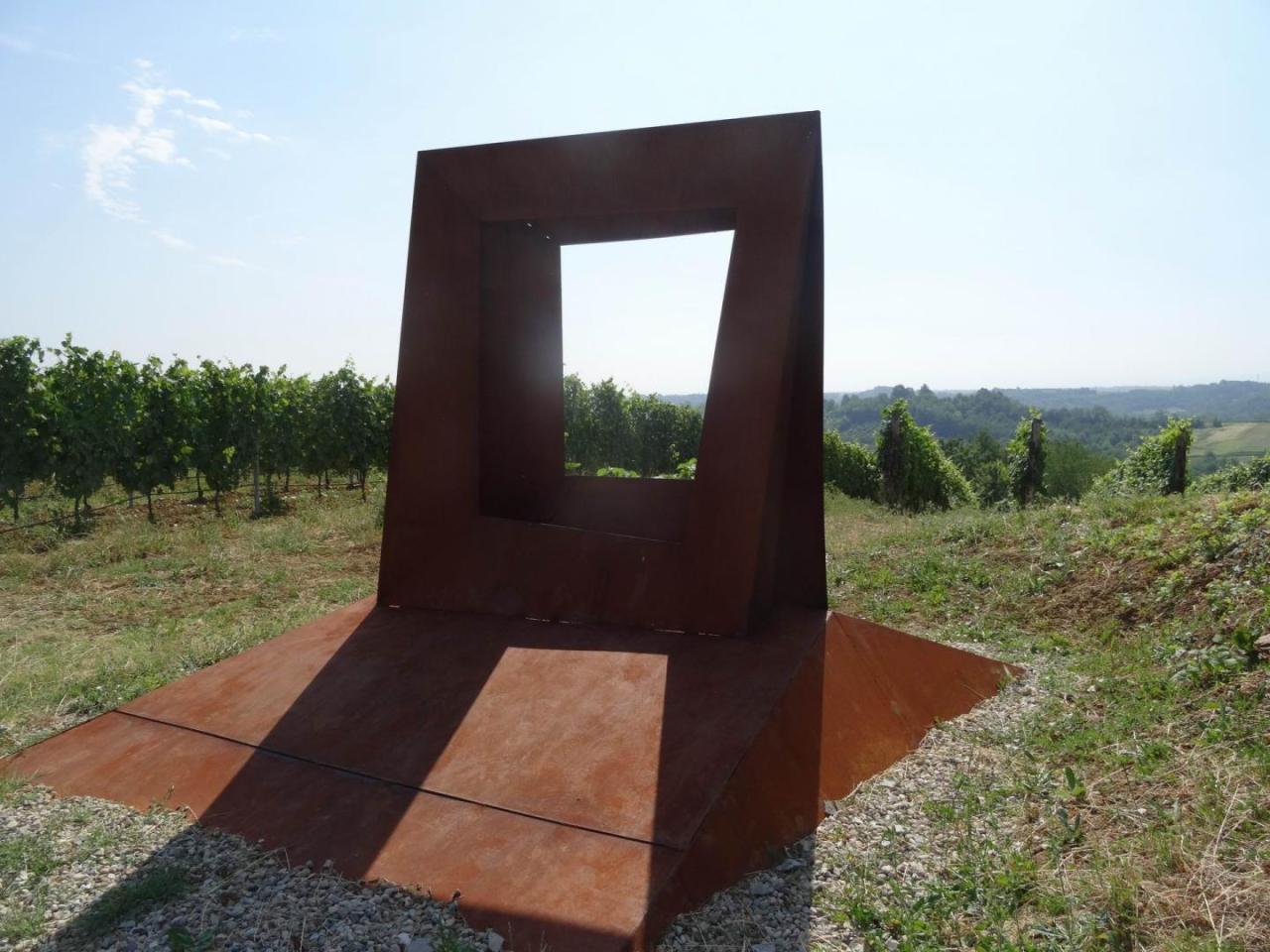
After completing section 3 Rocchetta-Cortiglione, you can continue along the route that leads to the important local geological site. You will then pass through the built-up area of Cortiglione and continue until you reach one of the elements characterising the entire FROM THE RIVER TO THE HILL itinerary, that is, the Cortiglione geosite.
Here, a clearly visible fossiliferous layer in the lower part of the outcrop is called the ‘Glycymerisinsubrica’ layer.
Most of the fossils are native to the area (which means that they lived, died and fossilised in situ) and represent a palaeocommunity developed on sandy-muddy bottoms of limited depth (20 to 25m). Just above the previous layer, a very concentrated layer called the ‘Isognomonmaxillatus’ layer, a mollusc with a characteristic grooved hinge and a scaly, pearly shell, is clearly visible. This layer is quite common in the Asti region and very important because it has been dated by scientific methods to around 3.3 million years ago.
This outcrop has a very interesting peculiarity: the two ‘Glycymerisinsubrica’ and ‘Isognomonmaxillatus’ layers, which are usually spaced vertically and a few metres apart, in this case are almost in contact with each other. In addition to the fossilised molluscs, the teeth of several species of sharks that inhabited the ancient sea have been found, which is quite rare in Piedmont in terms of variety in the Pliocene.